
As of the morning of Sept. 3, the ninth day of the Bhotekoshi flood, government figures show more than 1,200 bodies recovered and 4,216 people still unaccounted for. A full account of how many died in the flood has yet to emerge. Nearly 600 of the missing are from hydropower projects alone. And scientists say a second flood is still lodged in the mountains above.
Dhunche and Betrawati, Rasuwa—
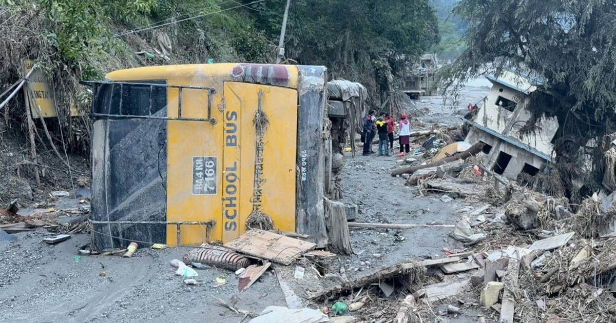
On the morning of August 26, Gita Maya Dangol was managing the canteen at Uttargaya Public School near Betrawati on the Nuwakot-Rasuwa border when students rushed in to warn her that the river was surging nearby.
 “I had no idea the river was coming,” she said. “It was the children who told me. At first, I said, ‘It must just be a small one like before. You kids are trying to trick me.’”
They told her it was far bigger than before, adding that a teacher had confirmed it. By then, she was standing right next to the water.
“If I had run that way toward the river bank instead of this way up the slope, I wouldn’t have survived,” she said.
She scrambled up the hillside behind the school building, walked for three or four hours to get out of the water’s reach, and stayed on the slopes for two days before moving on to Nuwakot. Five days later, she returned to look at the place where she had lived. She came back not to salvage anything, she said, but simply to look.
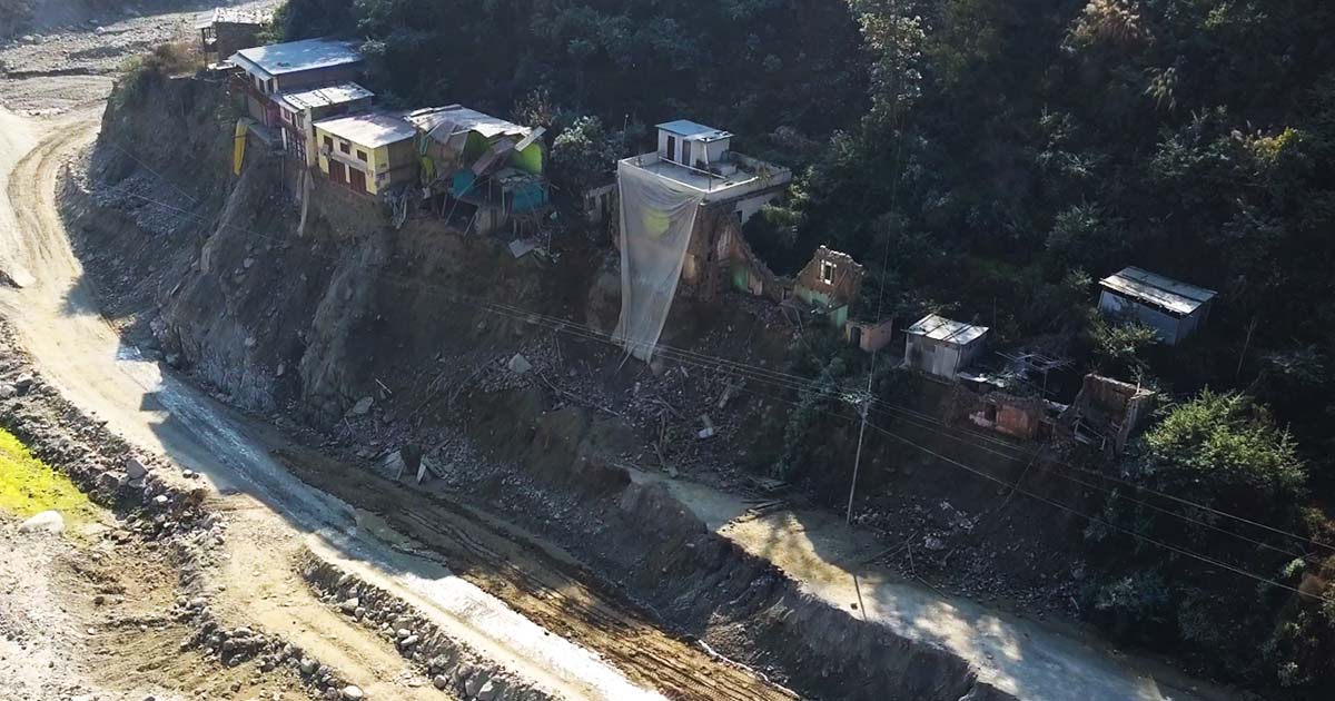
Her house is still standing, in the way a structure can remain standing while being entirely ruined. The bedding has been swept away. The animal pens are gone. The contents of the microfinance office that occupied the ground floor lie scattered outside in the mud. Five members of her family remain missing eight days after the deadly flash flood struck the region.
“This whole place is like a graveyard,” she said. “I am trembling with fear even as I walk here now.”
Nabaraj Sapkota, a school inspector in the education section of Bidur municipality, said more than 250 students from the municipality’s schools are missing – 150 from Uttargaya Public School and 100 from Ramchandra Basic School – along with 10 teachers and staff.
The Origins of the Mountain Collapse
Around 8:37 in the morning on August 26, about 20 kilometers upstream of the Rasuwagadhi border crossing and a vertical kilometer above any human settlement, a massive block of rock and ice broke off the northern flank of the Langtang Lirung massif.
It fell from an elevation of roughly 5,200 meters, slammed into a debris-covered glacier at 3,800 meters, swept up everything in its path, and plunged into the Lhende Khola at 2,900 meters. A rapid assessment by the Youth Alliance for Environment and Kathmandu University estimates that over 142 million cubic meters of ice, rock, sediment and debris surged downward at 15 meters per second, faster than a car driving through a village.
For a brief moment, the avalanche halted in the Lhende Khola, temporarily dammed by its own debris, before bursting through.
A seismometer near Langtang recorded a magnitude-5-plus signal, which was initially mistaken for an earthquake that triggered the avalanche. Similar anomalous seismic activity was also captured by Chinese seismic monitoring stations at Jilong and Zhangmu. It was not an earthquake. The government later confirmed that the signal was generated by the moving mass itself. The falling mountain was heavy enough to register as an earthquake as it came down.
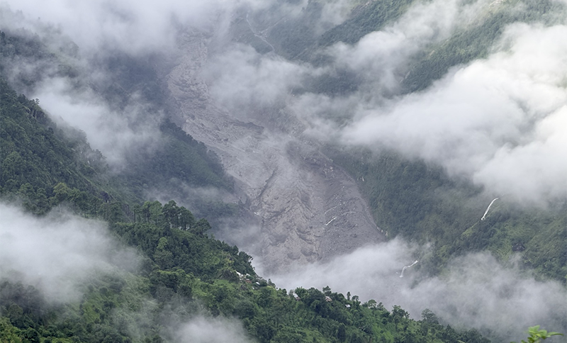
Scientists at the International Centre for Integrated Mountain Development (ICIMOD), who are investigating the event alongside partners in Nepal and China, remain cautious regarding the cause. “An ice avalanche in the Lhende Khola is the suspected trigger but the cause remains unconfirmed,” said Qianggong Zhang, head of climate and environmental risks at ICIMOD. The center noted that it is still too early to determine the exact role climate change played.
However, they are clear on one point. “The Lhende Khola has flooded twice in 14 months,” said Saswata Sanyal, a disaster risk specialist at ICIMOD.
Timeline of the Surge and Warning System Failures
8:37 a.m. The avalanche occurs. Within three minutes, the flood begins to move.
8:50 a.m. The hydrological station at Syabrubesi stops transmitting data. Its last recorded water level is 1.62 meters. The instrument built to detect this exact event is destroyed by it just 10 minutes in.
9:15 a.m. The Department of Hydrology and Meteorology confirms a major flood wave and issues warnings along the Trishuli corridor.
9:15 to 9:25 a.m. The flood surges into Nepal through Timure, Syabrubesi and Betrawati, destroying the Rasuwagadhi checkpoint. The torrent sweeps through the Bhotekoshi and Trishuli river valleys with catastrophic force.
10:28 a.m. It reaches Galchhi in Dhading.
11:50 a.m. Malekhu.
1:00 p.m. Mugling.
3:20 p.m. Devghat.
Downstream, the system worked. Galchhi had 73 minutes between the warning and the water, and it used them. Devghat had six hours.
Rasuwa had nothing. Between the mountain giving way and the water reaching Timure, there were about 35 minutes, and for most of that time, nobody in Kathmandu knew anything had happened. By the time the alert went out, the water was already surging through the villages it was meant to warn, and would have warned. Then the power failed and the phones went dead with it.
Addressing the Federal Parliament on September 2, Prime Minister Balendra Shah stated that the government was notified of the flood at 8:45 a.m., with a mobile alert reaching citizens at 9:35 a.m. Fifty minutes elapsed between the two. Within that timeframe, the surging waters destroyed the Rasuwagadhi checkpoint and swept through Timure toward Syabrubesi.
When asked why no timely warning was issued, he stated that the disaster was ‘beyond forecasting’. He added, “As soon as we received information that the flood was coming, our security personnel were deployed to alert local residents. They too have gone missing.”
His address made no reference to the July 2025 flash flood within the same river system, nor to the subsequent agreement signed between Nepal and China to share information regarding glacial flood risks. Furthermore, he made no mention of the Syabrubesi hydrological station.
There is one fact that cuts the deepest and it is the reason this story exists. After a smaller flood struck this same river system in July 2025, Nepal and China agreed to share cross-border information on glacial flood risks.
Fourteen months later, in the very same valley, the people at the top only learned a flood was coming by watching it arrive with their own eyes.
Surviving the Deluge in Syabrubesi
Mendo Gyalmo lives above Syabrubesi. She was getting ready to walk down to the market.
“It came at nine o'clock,” she said. “After it came at nine o’clock, we couldn’t see a thing.”
Had anyone warned her? Had there been any information?
“We didn’t know. It came all of a sudden. It was like, ‘What is this coming?’ We had no idea a flood was coming.”
She ran uphill, over the ridge. “And then I even cried. I cried wondering if I should go this way or that way, where I should go.”
Her grandson was at school. When a helicopter landed, she registered his name, folded her hands and begged them to take him to Dhunche. They did. She walked back down.
On August 31, she was still on the hillside above her own house, watching a landslide work its way toward it, and had not eaten a proper meal.
“There’s no rice, no salt, no gas,” she said. “We can’t go to the forest to collect firewood in this rain.”
Had relief reached her?
“No, no, no. We have received nothing so far. Nothing at all.”
Had the government told her to move higher?
“No. Not to us. No.”
Asked how many people from her area were gone, she stopped counting.
“Many are missing from here. It’s beyond words. In some houses, only one person is left. It swept away everyone.”
The government’s own report records 14,461 people, including 3,650 children, cut off from roads, electricity and telephones in the two worst-hit rural municipalities of Rasuwa for as long as six days.
The prime minister informed parliament that over 7 billion rupees has been collected in the relief fund, with 1 billion disbursed to the disaster management authority and 67.5 million rupees distributed among the 15 affected local governments, averaging 4.5 million rupees each. He added that contributions continue to arrive.
Meanwhile, the government reports that 11,993 individuals have been rescued over eight days, and of the 309 hospitalized, 195 have been discharged.
Destruction Across the Valley Floor
Sixty-eight bridges are gone. Between 40 and 45 kilometers of the Betrawati-Rasuwagadhi road no longer exist, and every main highway in Rasuwa is listed as completely obstructed until further notice.
Thirteen hydropower projects were damaged, taking 431 megawatts offline, roughly a tenth of the national grid. Sixteen schools were damaged or destroyed. The Rasuwagadhi-Gyirong crossing, Nepal’s main overland trade route into China, is blocked, and the customs post at Timure is gone.
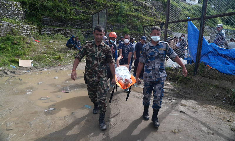
Four health facilities were destroyed outright, the health posts at Syabrubesi and Timure, the desk at Rasuwagadhi and the community health unit at Mailung. That is, in effect, the entire primary health system of the valley floor.
Surendra Gautam, a regional director with ADW International, reached the edge of Syabrubesi on August 30.
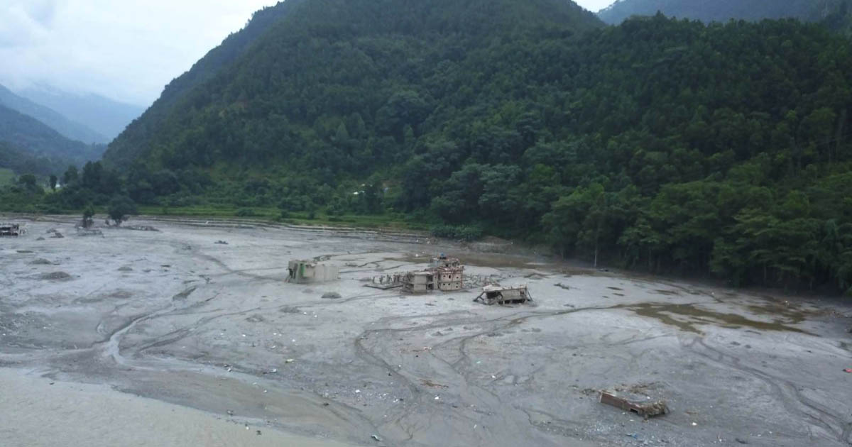
“We found that only a single building remained there in Syabrubesi,” he told NIMJN. “Other than that, there is nothing left.”
Above it, in Thulo Syabru, about a hundred households remain. Kancha Tamang, who ran a shop on the valley floor and cannot get back to it, described a district reduced to a helicopter map: the bridges gone, the crossing to the villages of Syo and Gre gone, and the route above blocked by the Runga River.
“Since there is no bridge here, they can only be transported if a helicopter is provided,” he said. “Those people have no other option, sir. No option at all.”
Asked what he wanted, he did not say food, money or an inquiry.
“If they install a bridge as soon as possible, all the people in this region can be rescued, and food and water will be sorted out.”
Trapped in the Hydropower Tunnels
Indra Prasad Gotame, a member of the Bagmati provincial parliament representing Rasuwa, was in Rasuwa on August 30.
“It is reported that there are over 300 people inside those tunnels,” he said. “There is hope that they might be alive. But we don’t have the technicians to go inside and there is intense pressure from relatives who believe those people might still be alive.”
Four men, he said, were brought out alive from the Rasuwagadhi tunnel. That is what the hope is built on.
“It is being said that technicians have come from outside,” he said, “But no technicians have arrived here yet.”
Two days later, the government published a figure twice the size of his. Of 4,216 people listed as missing, 639 fall under a single heading, ‘Hydropower Projects’.
The same report says Indian, Chinese, Korean and Nepali rescue teams ‘continue to be mobilized for joint search and rescue operations’ at four named sites, including Chilime.
Between an elected representative saying on August 30 that no technicians had reached him, and the state reporting on September 1 that four countries were working at four tunnels, there is a gap the families of 639 people are entitled to have explained.
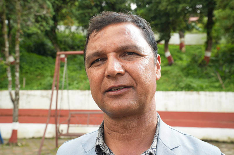
At Chilime, Kancha Tamang counted on his fingers the men from his own settlements who are inside, five from Kalathan, one from Sano Bharkhu. He had heard that 100 meters of the tunnel had filled with water and mud. A helicopter had gone in and brought out one body because the family had asked for it.
“You can see the mouth of that tunnel there,” he said. “Yes, it’s just a small opening.”
Uncounted Casualties Along the River
Here is the government’s death toll by district, as published on September 3.
Chitwan, 348. Nawalparasi East, 217. Nawalparasi West, 202. Nuwakot, 155. Rasuwa, 115. Gorkha, 69. Dhading, 60. Tanahun, 38.
Rasuwa is where the flood happened. Rasuwa is where the market town was reduced to a single building, where the border crossing was destroyed, and where 14,461 people spent six days cut off from the world. Yet, it has the lowest death toll of any affected district and the reason is not that Rasuwa was spared.
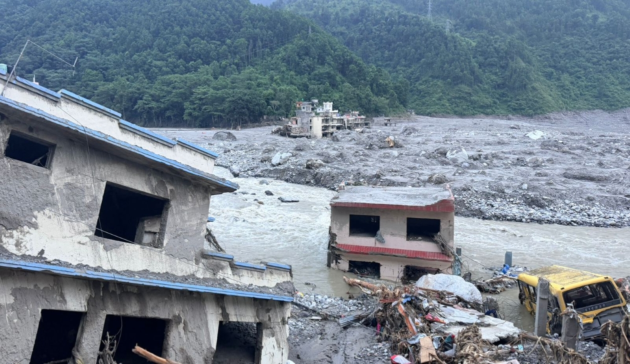
The reason is that the river carried its dead 200 kilometers south into the Narayani river system and deposited them in the plains, where the water slowed and where they are being recovered by people who did not know them. Unidentified bodies are currently being held at 21 hospitals across the country. The Nepal Police maintain a public database of them, while government logistics records show 1,146 body bags dispatched from the emergency warehouse at Kathmandu airport.
As of Sept. 3 morning, 1,204 bodies had been recovered, of which 95 have been identified and returned to their families. However, he did not specify where the DNA matching will take place, the timeline for the process or who will bear the cost.
A death toll organized by where a body was found, when the river is what moved it, is not a measure of where people died. Anyone reporting these figures, including this publication, has to make that distinction every time.
The missing column presents the same problem in another form. Reports have come in from 62 of Nepal’s 77 districts, because the men and women who worked along this river, in the tunnels, on the trucks, in the hotels and at the customs sheds, came from everywhere. The overall national missing list also includes dozens of security personnel, government workers and hundreds of visiting foreign nationals.
Shakeb Nabi, country director of the German aid organization Welthungerhilfe, was in the field and did not pretend otherwise.
“The biggest challenge I see in this humanitarian crisis is that we don’t know the number of people,” he said. “That’s tragic, that’s unfortunate.”
His point is not that the state is concealing anything. It is that the categories themselves have collapsed. People who survived did not stay behind to be counted. They walked to relatives in Nuwakot, to friends over the ridge or to Kathmandu if they could reach it. The phones died along with the power, leaving families to report people missing a week later, some of whom were actually alive three valleys away with dead handsets.
Devastation Downstream at Betrawati
Forty kilometers downstream, Madan Lal Lawat was on the road to Kathmandu when the news reached him. He turned around and returned on foot through the forest, stopping at Beltari, across the river, to look.
Three houses. His own, with the microfinance office on the ground floor. His elder brother Somlal’s, which housed the agriculture office. His elder sister Santamaya’s.
“This settlement has been set back hundreds of years,” he said. “There is no suitable land left to live on here.”
Five of his relatives are out of contact, two sisters-in-law, an elder brother and two aunts.
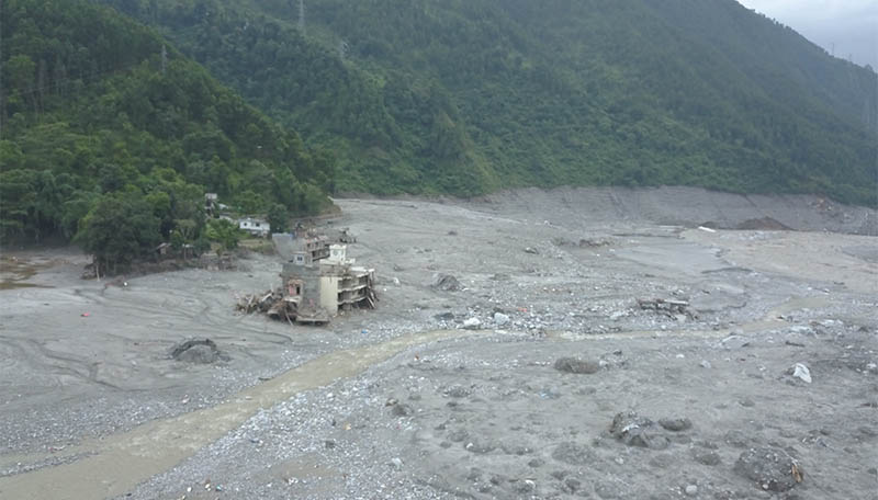
Betrawati was not only a market town. It was the sacred site of Uttargaya, featuring a Ram temple across the water and hosting an annual fair on the new moon of Paush. It drew pilgrims, trekkers and trucks bound for the Chinese border.
Sneha Shrestha, who arrived with an animal welfare group and has worked through many of Nepal’s disasters, noted that this one was distinct in a way she could smell.
“The river is filled with dead animals and they have already begun to rot completely,” she said. Her fear is disease, that if the human and animal remains are not cleared quickly, cholera and other water-borne pathogens will sweep through populations with nowhere else to seek refuge. “We are finding it hard to breathe here,” she said. “The survivors have to stay right here. They have nowhere else to go.”
That fear has now become a direct line in an official government document. Under the list of needs and priorities for Bidur, in Nuwakot, the state specifies the requirement: “Disinfectant/chemicals to control odor from dead animals and human remains.”
Asked whom she held responsible, Shrestha did not point to the weather.
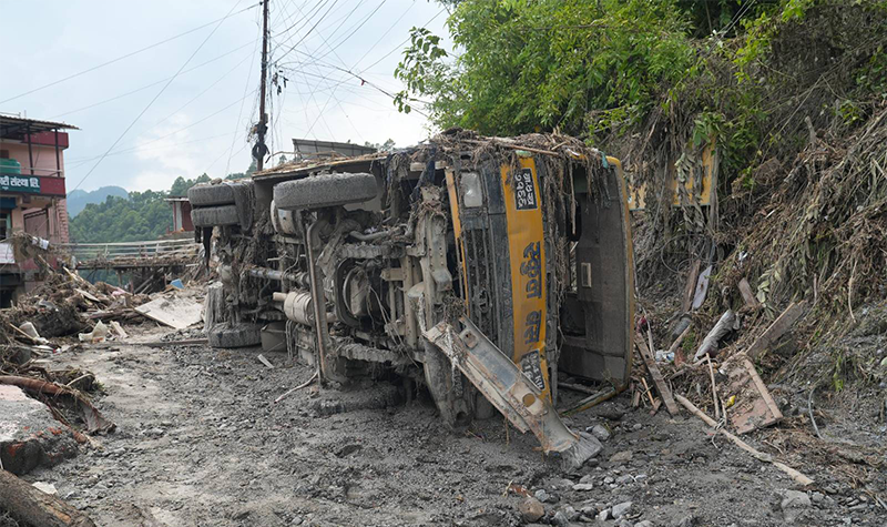
“A natural disaster is a natural disaster but I believe the blame for this ultimately rests on humans,” she said. “There is no ground left to absorb the water. We are building houses everywhere. And with the way we extract stone and sand from the rivers, both legally and illegally, the government needs to pay serious attention.”
The Threat of a Secondary Flood
The flood is not finished. The collapse blocked the river in more than one place. Some of those temporary lakes have drained. Others have not. Satellite images show a new lake forming in the hollow gouged out at 5,200 meters.
“With a blockage still lodged upstream on the Nepal-China border, authorities warn a second flood is imminent,” ICIMOD’s Qianggong Zhang said, “And evacuation orders are now in place for Jilong port, the Chinese side of the crossing.”
The government’s own assessment warns of ‘sudden river damming, lake breach floods, additional debris flows and secondary flooding events’, and that further rainfall could restart the entire sequence on slopes that have already given way once.
The people this would reach are those now living on the hillsides because the valley floor is gone. Mendo Gyalmo was awakened at four in the morning on August 31, and ran once more.
“We were very scared today too,” she said.
In Betrawati, on the morning of August 26, the warning arrived from three schoolchildren. It was correct, yet an adult initially doubted them.
Gita Maya Dangol survived anyway. She has lost her house, her livelihood and five members of her family. What she seeks from the state is not compensation.
“Our only hope for living is from the government,” she said. “We have nothing left ourselves. The children are just studying. I just want them to provide facilities for the children, make their education free and let them study well. That’s my only wish.”
Please adhere to our republishing policy if you'd like to republish this story. You can find the guidelines here.
Comments